Lagoa (Lagoa)
 |
 |
The area of Lagoa was settled just after the first colonists came to the island of São Miguel, and its first inhabitants established their homes in the areas that would eventually form the villages of Lagoa and Água de Pau. It is believed that early settlers chose the area for its sheltered bay, which was necessary for their loading and unloading of cargo, livestock and provisions. The Porto dos Carneiros was one of these areas, so named for the fact that sheep, as well as other animals, were offloaded within its cove. The celebrated Portuguese historian, Father Gaspar Frutuoso referred to Lagoa, in the way that the first settlers named it, a name that was dependent on where they made their homes:
* “The village of Lagoa, called this owing to the existence of a "lake in front" of the doors to the Church (a reef) and its port where [it was large enough for ships] to battle, where in the past there were large catches of fish, since the ocean would enter it, and the livestock would drink from its waters and others would pass time swimming in its waters..."
It was in the area of the Church of Santa Cruz that most of these original founders established their homes, near an ancient lake (long since dried up). In the 15th century, the island of São Miguel continued to receive settlers and in Lagoa those colonists steadily settled farther to the west, around the bay that became known as Porto dos Carneiros, where fishing began to take on an important aspect of the local economy. To the east of the village of Lagoa, several families established agrarian settlements in the vicinity of Água de Pau.
Around 1515, due to its social and economic growth the village of Água de Pau was elevated to Villa and made temporary municipal seat of the newly incorporated municipality of Lagoa. By this time, the historian Father Gaspar Frutuoso noted in his tome Saudades da Terra the 100 homes existed in the community; a comparable size to the other centers on the island, but only half the size of Ponta Delgada (250), Vila Franca do Campo (200) or Ribeira Grande (200). In 1522 (April 11) Lagoa, the village, became the municipal seat of the municipality, at a time when the population hovered around 1000 people and 300 homes. At the time, it was considered one of the more productive agricultural areas of the island, responsible for wheat, wine and woad production. Its port was the important regional point of entry and exit for many of its products, in addition to fishing center.
The communities prosperity extended into the 19th century, when the village was the center of a flourishing ceramic industry and distillation of alcohol and spirits. By the 20th century these industries were supplemented by factories for the production of vegetable oil, soap and animal feeds, at a time when agricultural production and the fishery was also dominant. At the end of the 20th century, the tertiary sector had taken on a significant part of the areas economy (58.2% of the population was active in these activities), while the number of new companies involved in the sector grew (17.2%, between 2001 and 2004).
Map - Lagoa (Lagoa)
Map
Country - Portugal
 |
 |
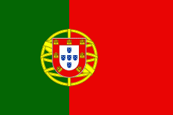
| Flag of Portugal | |
One of the oldest countries in Europe, its territory has been continuously settled, invaded and fought over since prehistoric times. The territory was first inhabited by pre-Roman and Celtic peoples who had contact with Phoenicians, ancient Greeks and Carthaginians. It was later ruled by the Romans, followed by the invasions of Germanic peoples and the Islamic invasion by the Moors, whose rule was eventually expelled during the Reconquista. Founded first as a county of the Kingdom of León in 868, gained its independence as the Kingdom of Portugal with the Treaty of Zamora in 1143.
Currency / Language
| ISO | Currency | Symbol | Significant figures |
|---|---|---|---|
| EUR | Euro | € | 2 |
| ISO | Language |
|---|---|
| PT | Portuguese language |


